

 Retour
randonnee
Retour
randonnee
Towards the pasture of Agy - Hike
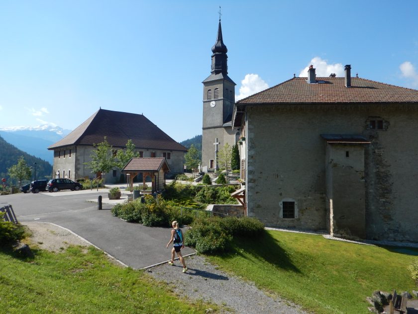
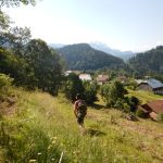
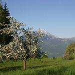
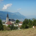
Pleasant stroll in the woods despite the steady rise from the start to the alpine pastures of St-Sigismond. At the top, admire the view of Mont Blanc and the Giffre massif.
Description
Step-by-step guide:
From Saint-Sigismond town hall to Fimaloz: 2 hours From the town hall, take the road towards Agy via Les Granges de la Frasse. Follow the arrows to Chemin du Jourdil. From there, go up the road on the left. At the hairpin bend, take the path on the left onto Chemin de la Berchère. Continue along the track until you reach a plateau with a beautiful view. Pass the barn and turn immediately left, following signs for “Agy - La Croix.” Cross the stream and climb up to the left onto the very wet path. Then cross the three footbridges in succession and take the path that continues to the right into the forest. The path is shaded by the trees. When you arrive at Les Granges, follow “Agy (La Croix)” again. You will arrive at Les Chalets de Fimaloz, where you can enjoy a beautiful view. From Fimaloz to Agy (La Croix): 30 minutes When you reach the signpost marked “Fimaloz,” follow the direction “Agy (La Croix) via La Bordaz.” Then continue toward “Agy (La Croix).” You will pass the La Tanière restaurant and the cross-country ski center. Once you have passed the car park, you will arrive at Agy (La Croix). From Agy (La Croix) to Les Hauts Choseaux: 40 minutes To descend from La Croix, retrace your steps. Return to the departmental road and follow the path on the left, which descends below the road. After approximately 500 meters, cross the road again and continue descending to the village of Agy. The trail crosses the road several times before arriving at the hamlet of Les Hauts Choseaux. From Les Hauts Choseaux to the town hall of Saint-Sigismond: 35 minutes At the crossroads, go straight ahead towards the Croix du Chêne. When you reach the cross, take the paved road on the left until it ends. The road continues and becomes a path. At the crossroads, turn left to reach the town hall parking lot.
Environnements
-
 Forest location
-
Mountain view
-
Mountain location
-
Village 2 km away
Tarifs
Free access.
Itinéraire
-
 Distance
7.6km
Distance
7.6km
-
 Type d'itinéraire
BOUCLE
Type d'itinéraire
BOUCLE
-
 Dénivelé positif
360m
Dénivelé positif
360m
-
 Dénivelé négatif
360m
Dénivelé négatif
360m
-
 Durée journalière
02h35
Durée journalière
02h35
-
 Itinéraire balisé
Oui
Itinéraire balisé
Oui
-
 Précision balisage
Trail marked with directional posts (PDIPR)
Précision balisage
Trail marked with directional posts (PDIPR)
-
 Nature du terrain
Stone,
Ground,
Not suitable for strollers
Nature du terrain
Stone,
Ground,
Not suitable for strollers
-
 Altitude maximum
1338m
Altitude maximum
1338m
Période d'ouverture
Closed temporarily.
Localisation
From Cluses, take the D902 to Châtillon-sur-Cluses. At the roundabout, take the D6 on the right, direction Saint-Sigismond. In the center of the village of Saint-Sigismond, take the road going up to the left, direction Agy. Park in the town hall square.
Animaux
Animaux acceptés : Oui
Animaux acceptés avec supplément : Non
Keep your dog on a leash, he can scare off herds and wild animals.


-
Distance
7.6km
-
Durée journalière
02h35
-
Dénivelé positif
360m
-
Dénivelé négatif
360m